
January 7, 2016
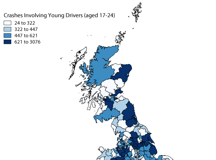
[iframe width=’100%’ height=’520′ frameborder=’0′ src=’https://aha83.cartodb.com/viz/5b716b7e-0b66-11e5-a84e-0e5e07bb5d8a/embed_map’ allowfullscreen webkitallowfullscreen mozallowfullscreen oallowfullscreen msallowfullscreen] [/vc_column_text] [vc_column_text pb_margin_bottom=”no” pb_border_bottom=”no” width=”1/1″ el_position=”first last”] The first shows the prevalence of crashes […]

